HoLLIE – week 3
/The Week 3 of HoLLIE (Howard County Legacy Leadership for the Environment) class day was last week and it was held at NASA Goddard like the second week. The theme for the day was continued from last week: “what informed citizens need to know about earth systems science.”
The first talk of the day as about ice sheets and included a discussion of the speakers trek to the South Pole last year. Check out her ICESat-2 Antarctic Traverse Blog (The first post is from December 4, 2017. If you want to start with that one and read in chronological order, scroll down to the bottom of this page until you get to ‘Heading South, to New Zealand and Beyond.’ Then after reading the ‘South Pole Station: The Last Stop Before the Traverse’ beginning at the top of the page, click on ‘newer entries’ to read the rest of the of the posts – and again start with the post at the bottom of the page and work up). She spent Christmas at the South Pole!

She recommended a book that I found could be checked out from Internet Archive when I got home: The two-mile time machine by Richard B. Alley. The book is about the annual rings of ice from cores drilled in Greenland and what they tell us about Earth’s climate over time.
The second talk was about the Land-Based Hydrology Cycle. This talk included what we can learn from satellites but also what measurements are taken on land too (and how much effort that takes…to get even sporadic data). With fresh water being so key to life – the very highs (floods) and very lows (droughts) are major impact all around the world.
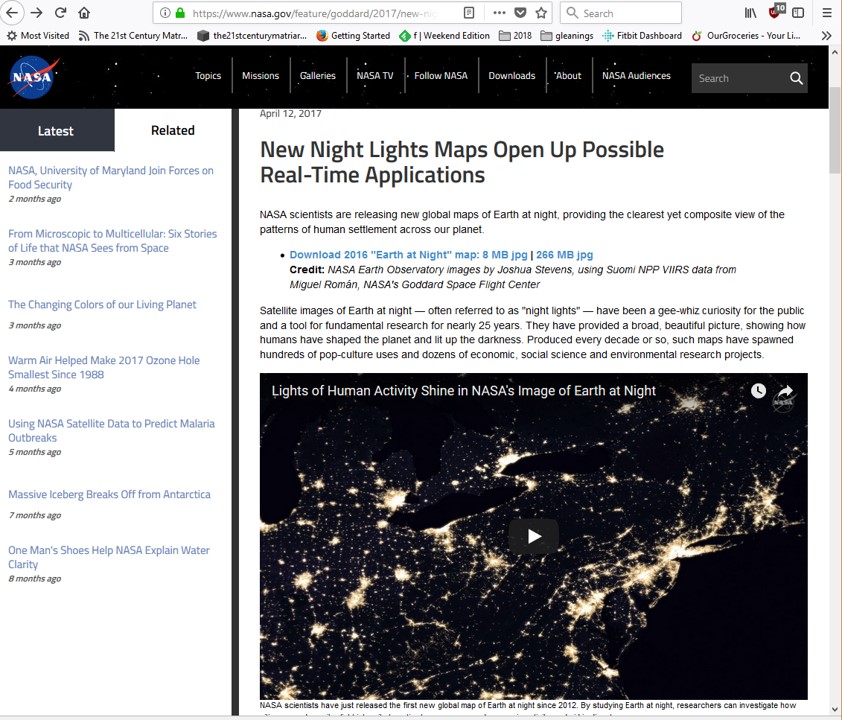
The third talk was about the Black Marble project…about what we can learn from looking at the earth at night. Back in April there was good summation of the project – to create the images more frequently so that they could be used more even more applications (like short-term weather forecasting and disaster response): New Night Lights Maps Open Up Possible Real-Time Applications - https://www.nasa.gov/feature/goddard/2017/new-night-lights-maps-open-up-possible-real-time-applications; take a look at the map of India midway through the article and slide the vertical bar to the see how the northern part of the country was electrified between 2012 and 2016. There is more at https://earthobservatory.nasa.gov/Features/NightLights/.
The fourth talk was about how the Montreal Protocol saved the earth’s ozone layer. I knew the protocol concerned Ozone and CFCs….but didn’t realize any more history than that. The timing of a report that linked CFCs to ozone depletion just before the ‘hole’ was discovered in the ozone layer (a major change from measures of ozone for many years beforehand) over Antarctica made for a dramatic beginning to the conversation. It has been effective because governments engaged industry that provided substitutes (some transitional) that made it possible to move away from compounds that were ozone damaging in the stratosphere.
Next we visited NASA’s Scientific Visualization Studio – seeing some of their recent work on a wall sized screen. Here are some web versions of what we saw in the studio:
NASA's Near-Earth Science Mission Fleet: March 2017
Global Temperature Anomalies from 1880 to 2017
Weekly Animation of Arctic Sea Ice Age with Two Graphs: 1984 - 2016